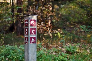
The Greenbelt Foundation has unveiled 45 new trailhead and wayfinding signs on Toronto and Region Conservation Authority (TRCA) land in the Oak Ridges Moraine.
All 45 installed signs convey the TRCA property or location, illustrate the Oak Ridges Moraine trail, and highlight the trail’s location within the Greenbelt. TRCA is the largest public lands holder in the Greater Toronto Area, with much of its land falling within the Oak Ridges Moraine and Greenbelt. Within this system of greenspace is approximately 60 km (37 miles) of the Oak Ridges Moraine main and side trails.
“These new signs will educate visitors about the Oak Ridges Moraine and help them to understand the role it plays within the greater Greenbelt landscape,” said Edward McDonnell, CEO of the Greenbelt Foundation. “Signage is an important strategy to improving access to greenspace and can contribute to making experiences more meaningful by providing education and information about the area. We are thrilled that this new signage will make it easier for Ontarians to access the Oak Ridges Moraine trail and help visitors get more out of the experience while they’re there.”

The Greenbelt Foundation has unveiled 45 new trailhead and wayfinding signs on Toronto and Region Conservation Authority (TRCA) land in the Oak Ridges Moraine. Photo © Big Stock.
The installation of these new signs which has been led by TRCA staff are located primarily at vehicle and pedestrian access points that comprise the Oak Ridges Moraine Trail.
“The installation of the trail kiosks will go a long way in directing the public to the trailheads where they can enjoy either personal or family hikes or to join one of our many guided hikes,” says Kevin Lowe, president, Oak Ridges Trail Association.
Beyond the additional signage, the TRCA also has a formal agreement in place with the Oak Ridges Trail Association (ORTA) for regular trail maintenance wherever it exists on TRCA property.


